2020-10-16 14:49
 ► 0:26
Example of the stabilizer in action. Left side stabilized, right original.
Bigsh0t Optimized and Stabilized
2019-07-20 12:10

 ► 0:16
2018-09-23 11:07

2017-08-01 09:03
2017-07-31 21:26


The panorama has been edited to make the landscape line up better and a seam has been covered using digital manipulation tools. See the "petals" at the bottom - the one to the right of the little Sojourner rover shows where the seam was. Original Image Credit: NASA


Updated 2017-08-23: All panoramas, in a click-able, navigable, tour!
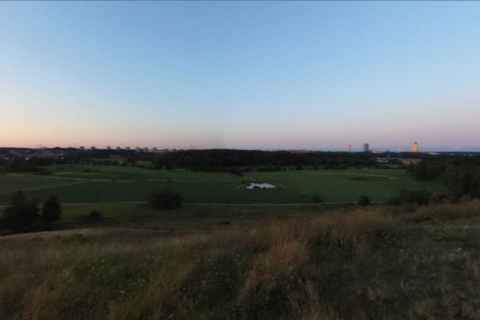
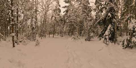
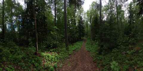
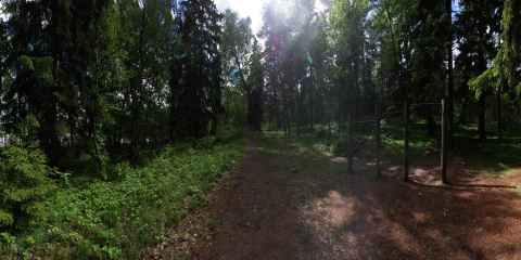
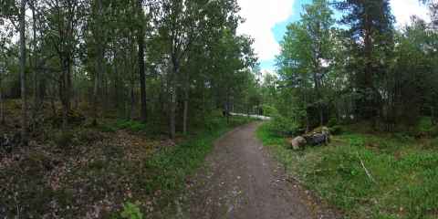
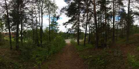
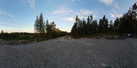
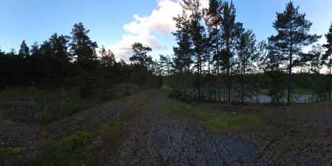
Little Jogging Track (Lilla Slingan)
2012-06-04 11:55

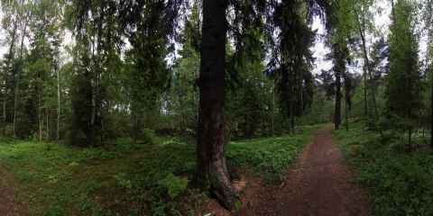
This photo was taken approximately where the start of the track used to be, facing in the direction you'd run. The red brick building to the right is IBM's headquarters, which gave this area the nickname "The IBM-forest".
Little Jogging Track (Lilla Slingan)
2012-06-20 21:01

This is a small surviving part near Lagtingsgatan - and the only part that I thought was left on this side of the road. If you look ahead, down the slope, you can see the road cutting across the track.
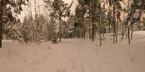
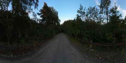
Little Jogging Track (Lilla Slingan)
2012-06-04 12:54

Here we have crossed Lagtingsgatan. If you look back across the road, you can see a small yellow sign near a birch tree. That's where the previous section of the track ended.
Little Jogging Track (Lilla Slingan)
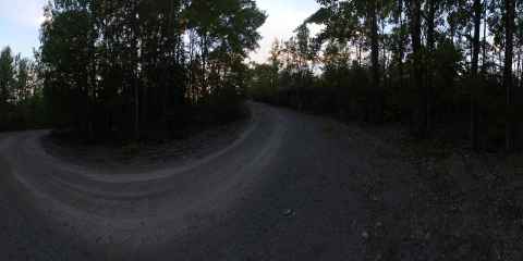
2012-06-04 13:27

This is where the track turns around and makes its way back up over Töjnanberget and back to the start point. Every time I ran the track, I would think of this as the half way point - and I'd be wrong every time. In reality, there's about 2/3rds left.
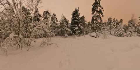
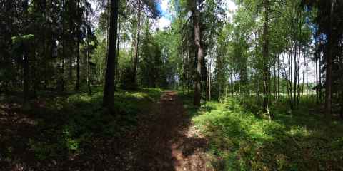
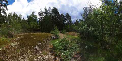
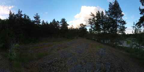
Little Jogging Track (Lilla Slingan)
2012-06-04 13:31

This is the lowest part of the track, 35m above sea level.
Little Jogging Track (Lilla Slingan)
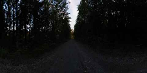
2012-06-04 13:39

This is the second point where the track has been cut off by the new road.
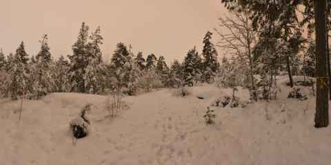
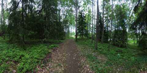
Little Jogging Track (Lilla Slingan)
2012-06-04 13:40

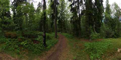
This section is remembered by me for not being remembered. Every time I'd run the track, I'd be surprised that this part was so much longer than I remembered. I would typically expect the goal to come up about now, and be equally disappointed every time.
Little Jogging Track (Lilla Slingan)
2012-06-20 21:08

The sign on the tree says "Forbidden Entry" - strangely enough, it only applies to entering the track from this direction - there were no signs on the other end of this segment.
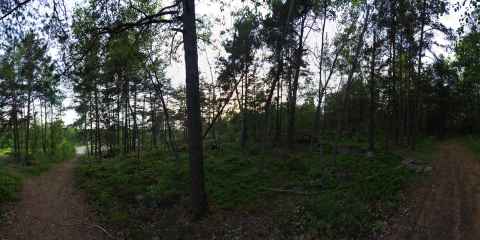
Little Jogging Track (Lilla Slingan)
2012-06-04 13:01

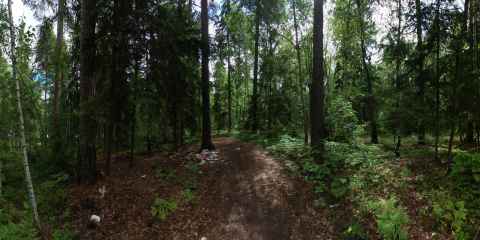
The track used to go where closest lane of the road is now. This part had a "workout station" consisting of three logs that one could lift.
Little Jogging Track (Lilla Slingan)
2012-06-04 13:04

Here the newest road cuts across the track. The big rock that is in the middle of the track a little bit back wasn't put there by the construction, but had slid down prior to this.
Little Jogging Track (Lilla Slingan)
2012-06-04 13:05

The other side of the newest road.
Little Jogging Track (Lilla Slingan)
2012-06-04 20:44

The sign that you can see hanging up ahead is another "Forbidden Entry" sign; and as with the previous one, it appears to only apply to people going the other way.
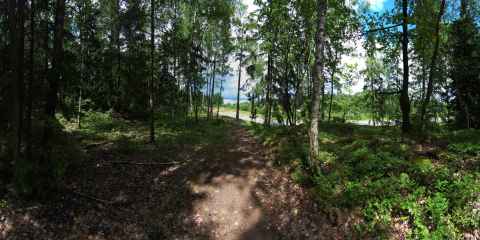
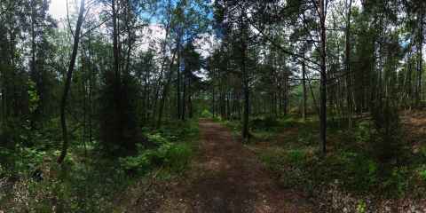
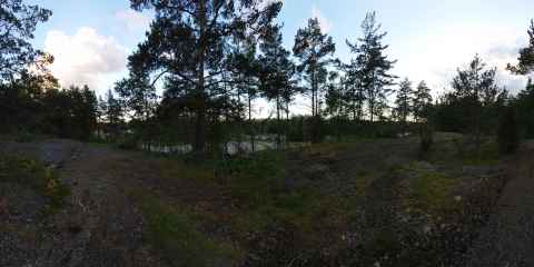
Little Jogging Track (Lilla Slingan)
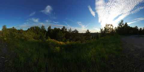
2012-06-04 12:09

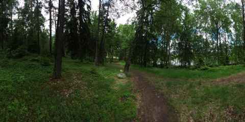
This is one of the most beautiful spots on the track. Not only does the forst open up a bit so you get a clear sky, when you passed this you knew that the goal was right up ahead. For real, this time.
Little Jogging Track (Lilla Slingan)
2012-06-04 11:55

This the highest spot on the track, 52m above sea level
Little Jogging Track (Lilla Slingan)
2012-06-04 11:37

This was the final slope coming down to the goal, which was a little bit beyond where the track currently ends.
Little Jogging Track (Lilla Slingan)
2012-06-04 12:47
 side of the valley.")
This VR bubble was shot hand-held. Looking down the valley one can just about see the stone structures of Tambomachay on the south (right) side of the valley.
2012-01-03 13:51

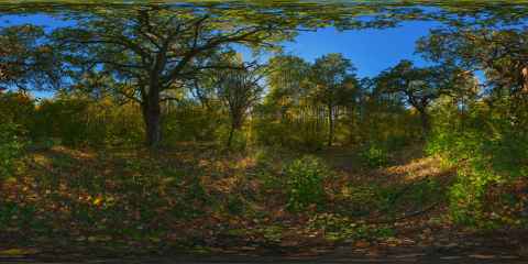
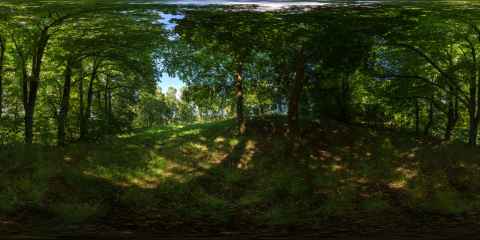
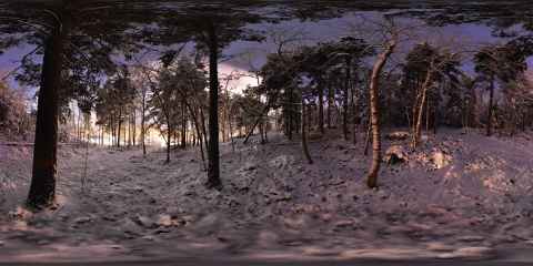
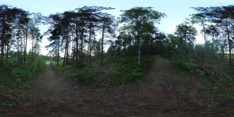
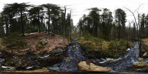
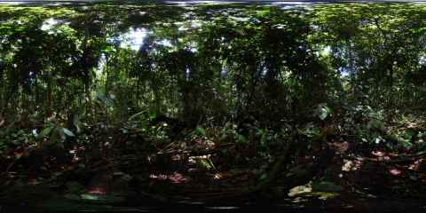
Forest Panorama
The purpose of the forest panorama was to have a photo of nothing much in particular - just compact forest, with no trails or other interruptions. I wanted it to be as close to a representative sample of one of the kind of forest that you find in Tyresta. It also had to be pretty to look at. I finally found this spot that satisfied both requirements.
I shot the panorama hand-held using a Sigma 10-20mm lens. I used 20mm for the horizon, and switched to 10mm for the top and bottom. While shooting hand-held always means more work when stitching, this time it turned out to be a nightmare. While the forest floor worked out all right - more or less, but who will ever see the difference - the part with tree trunks silhouetted against the bright sky turned out to be a lot more difficult. If the details on the forest floor won't line up properly, the image blending will take care of it. There is so much visual noise in the region that the seam line can be hidden well. But the trunks provided a challenge: A straight tree trunk that suddenly veers off in another direction, or one where the trunk abruptly shifts to one side; those are elements that jump out at the viewer.
The panorama was finished with a couple of hours in Photoshop. Patches were copied, stretched and distorted to cover up the stitching errors. Would a panoramic tripod head have made it easier? Undoubtedly. But the tops of the trees were swaying in the wind, so even if I had carried my Nodal Ninja Mk. III it would have come down to 'shopping.
2011-10-04 13:51

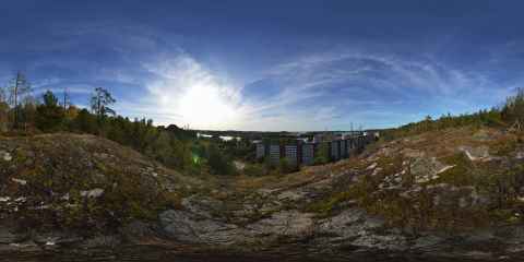
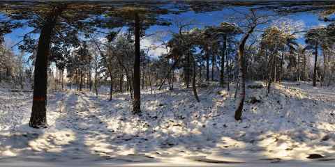
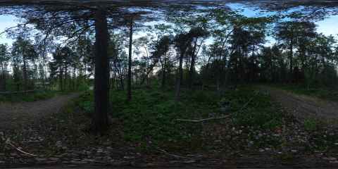
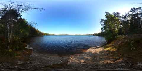
Stensjön Islands
I'm particularly happy about finding this spot. On Tyresta's homepage there is a photo from (I suspect) here, showing the two islands that can be seen in the panorama, and I had always wondered where it was taken from but never been able figured it out until now. In this area there are some fairly steep cliffs leading into the water, which made it a good place for set up a hill fort; something the locals did a long time ago in order to have a place to retreat to in times of unrest. I don't know when the fort remnants date from, but it was listed by the government of Sweden in 1668 and is listed as Tyresö 106:1 / Stensjöborg[e].
The fort covers two hilltops - an eastern and a western - with a narrow notch between them. On each side of the notch the hills, which are basically two big, bare rocks, rise near vertically. It is not difficult to imagine that an attacker would have to fight very hard to successfully assault anyone defending the fort. It was this notch that confused me last time. The western hilltop is slightly lower than the eastern, and the line of sight to the water is obscured by trees. I tried to find a spot where I could see the islands from when I was here the first time. No luck. Moving towards the notch I was faced with a steep rock face, which made me conclude that there was no success to be had in that direction. This time, however, I went north and found a place where one could climb up on the eastern hilltop by following the remnants of the defensive wall up the hill.
Success!
As the tracklog shows, it is possible to descend the hilltop to the east. One has to zig-zag among sharp drops and leftovers of walls, but it can be done.
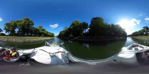
2011-10-04 15:42


I'm very satisfied with this panorama, because it was shot hand-held with a single lens - the Sigma 10-20mm f/4-5.6. I used 20mm along the horizon and 10mm for the six up and six down shots. There are some stiching errors that you can see if you look down, but all in all it ended up much better than I had expected it to. Much faster to shoot, as well.
For visitors with Firefox, Chrome, (Mobile) Safari or any webkit-based browser supporting CSS 3D or WebGL, the panorama above is presented using Bigshot VR, and not SaladoPlayer. I figure Bigshot is good enough to dogfood right now, so I turned it on for all 360 panoramas on the blog.
2011-04-30 13:35

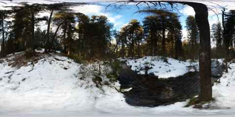
This was the first VR panorama I shot. It turned into a nightmare, but fortunately the shooting conditions were fairly constant. In an attempt at getting the tripod out of the image as much as possible, I set it up with the feet in a very small triangle. Combined with uneven ground hidden beneath the snow, a lot of fumbling by me, and a desire to not disturb the snow I ended up bumping the tripod a lot. I also managed to forget at least one step in my list every time I tried to get it right. Persistence pays off, though, and once done I was a lot more prepared for the next two shots.
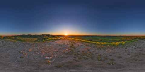
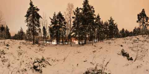
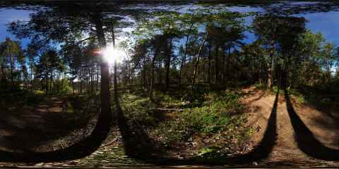
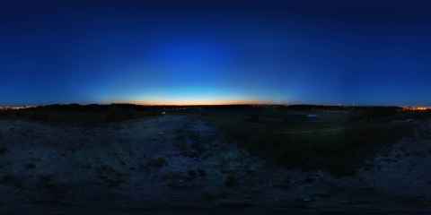
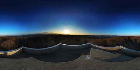
2011-01-14 13:18
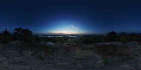
. Like the first and second, there was a lot of fumbling and stress. This time it wasn't as much caused by forgetting things - it was related to the rapidly changing conditions. In the panorama you can find the sun, a bunch of clouds and the burnt area. I wanted to get them all properly placed and exposed in the image. This meant I had to find the right time where the sun lit up the clouds the way I wanted, and where I could get an exposure that would capture both the view toward the sun and out toward the burnt area without losing shadow or highlight detail. Of course, once perfect shooting conditions appeared, I had to get my 24 shots done before they disappeared.")
This is the third panorama I shot (the second didn't turn out as well, with a lot less interesting sky). Like the first and second, there was a lot of fumbling and stress. This time it wasn't as much caused by forgetting things - it was related to the rapidly changing conditions. In the panorama you can find the sun, a bunch of clouds and the burnt area. I wanted to get them all properly placed and exposed in the image. This meant I had to find the right time where the sun lit up the clouds the way I wanted, and where I could get an exposure that would capture both the view toward the sun and out toward the burnt area without losing shadow or highlight detail. Of course, once perfect shooting conditions appeared, I had to get my 24 shots[f] done before they disappeared.
I briefly toyed with the idea of shooting the panorama in priority order. That is, get the most important shots done first, then fill in the rest. I then realized that if the conditions changed between the high-priority shots and the low-priority shots, I'd be without a panorama no matter the order, as they would be a nightmare to assemble. It was therefore to my advantage to just stick to the routine - get all the 24 shots as fast as possible.
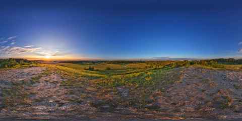
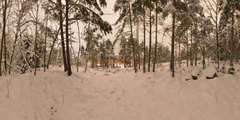
2011-01-14 14:01

The final panorama. By now I had gotten the actual shooting down to routine. I also decided to get the moon into the panorama, as it was visible since the clouds had moved away. The challenges were to find the right spot where the moon was seen, find the right exposure and shoot at the right time. Add to that the fact that the moon is moving and disappears behind a tree every now and then and you get a couple of variables to juggle. I was also worrying about the nadir image. In my attempts are finding the best position I had moved the tripod around and left a lot of footsteps in the previously undisturbed snow. Getting them out of the panorama would be quite a task. I also had to switch to a timed remote release, as the camera was wobbling a little bit every time I rotated it to a new position. This added two seconds to each shot, or almost a minute in total.
This was the first panorama I assembled when I got back home, and just as with the shooting, the first time I couldn't get anything right. I mis-aligned the photos, got bad zenith and nadir images, and so on. I think it took something on the order of eight hours to get the editing done. By the end I had a 1.2GB PSD file that took a couple of minutes to save, and my computer was swapping all the time. I considered including "a book to read" in my list of equipment for VR panoramas - it'll keep you from boredom while you wait for the computer to do something.
2011-01-14 14:50