
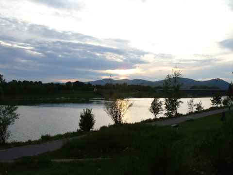
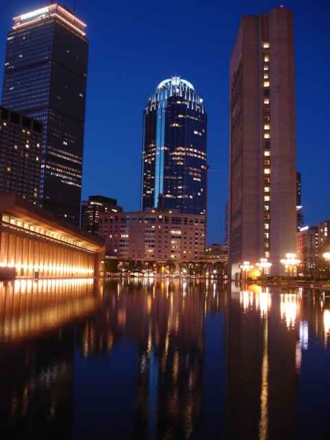
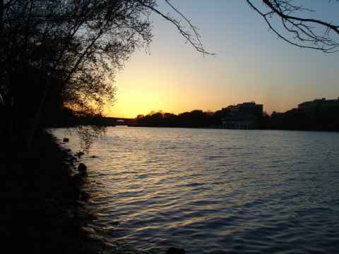
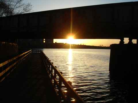
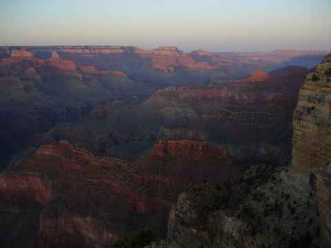
View north along the river after sunset.
2006-12-27 17:54

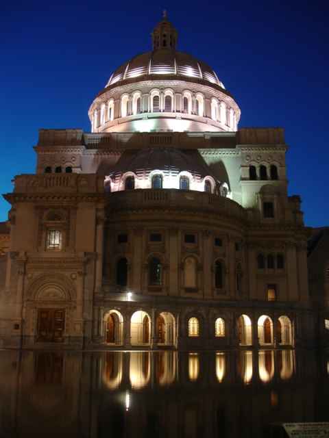
The cathedral, as seen from the graveyard.
2006-12-27 17:34

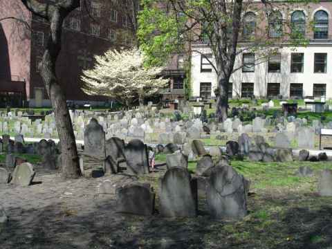
, at the foot of Fort Hill.")
St.Peters Friedhof (graveyard), at the foot of Fort Hill.
2006-12-27 17:28


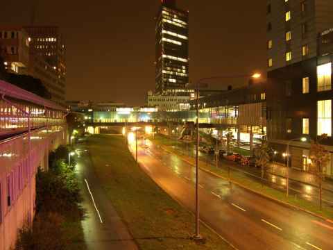
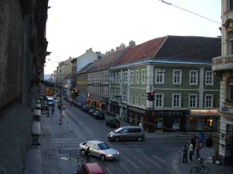
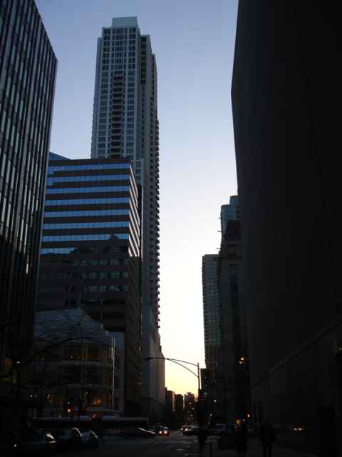
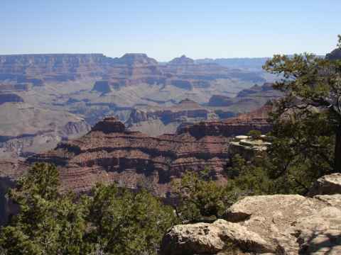
View north along the Salzach river
2006-12-27 16:27

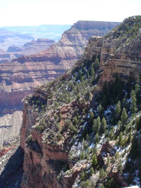
View south along the Salzach river.
2006-12-27 15:15

A wishing well near the cathedral. Water comes from the hills and rushes down the hole.
2006-12-27 16:08

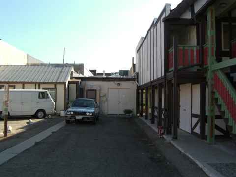
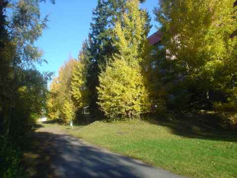
A very compact house squeezed in.
2006-12-27 15:03


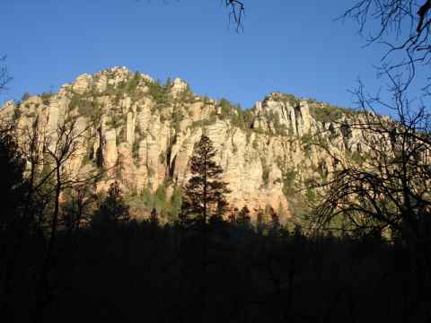
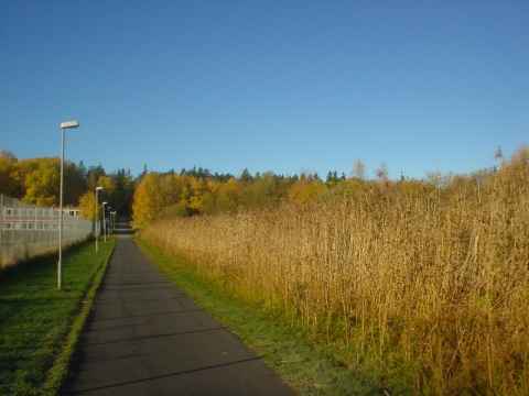
View west along the northern wall.
2006-12-27 14:32


Cargo funicular leading up from the road.
2006-12-27 14:28
 chapel. On the floor you can see pieces of fresco and decorations that were found in the archaeological dig.")
This is an ancient Romanesque (looks Roman, but they didn't build it) chapel. On the floor you can see pieces of fresco and decorations that were found in the archaeological dig.
2006-12-27 14:24

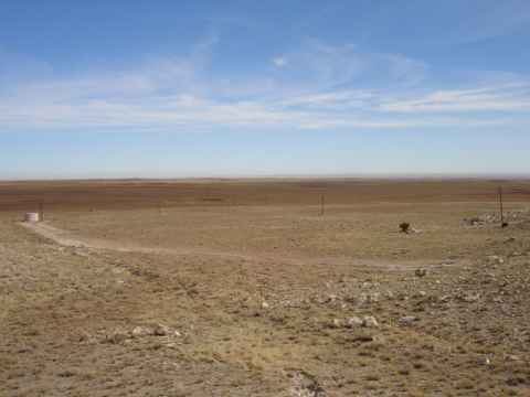
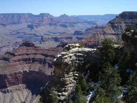
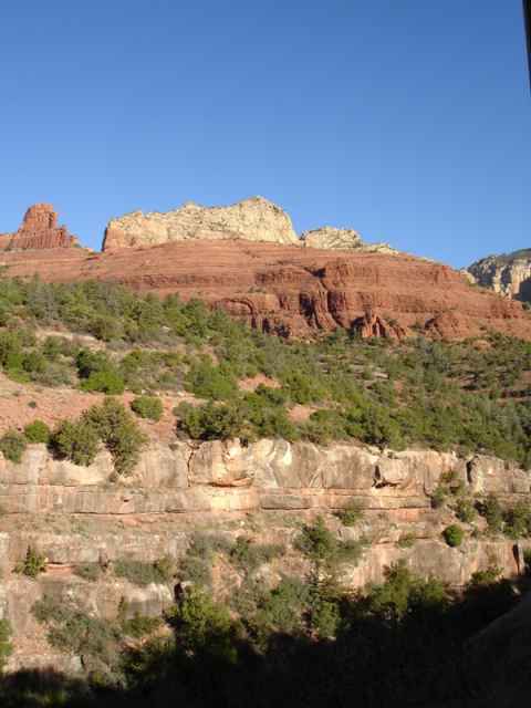
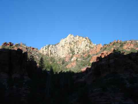
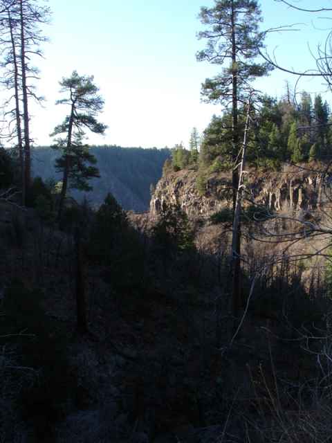
This is the top of Fort Hill, laid bare.
2006-12-27 14:18
, that was found by archaeologists on the peak of the mountain.")
The top of the hill has been used since way back in time. These are the remnants of an old oven (basically a through used for burning wood in), that was found by archaeologists on the peak of the mountain.
2006-12-27 14:18


Masonry heater from the officers' quarters.
2006-12-27 14:07

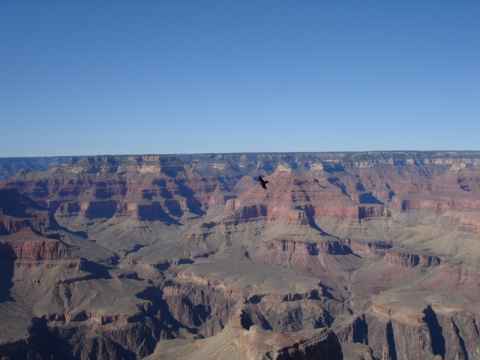
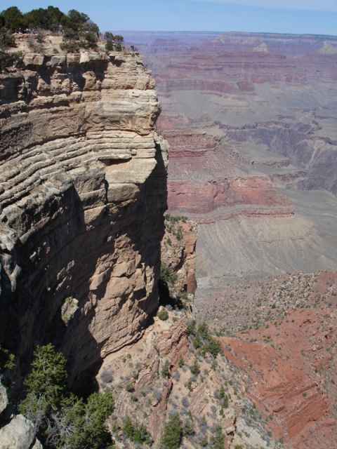
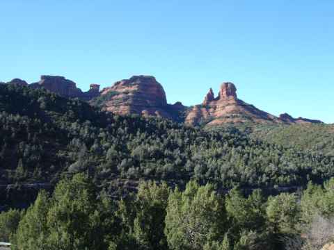
View of Salzburg - with the old town being closest - from the fort. The church at the bottom right is the Salzburg Cathedral.
2006-12-27 13:57

Interior of the Salzburg Cathedral[a]'s dome.
2006-12-27 13:35

Interior of the Salzburg Cathedral[b].
2006-12-27 13:33


Detail from the University Church.
2006-12-27 12:42
 are connected by passages through the buildings, leading to interior courts such as this one.")
The main streets (as main as the go) are connected by passages through the buildings, leading to interior courts such as this one.
2006-12-27 12:33

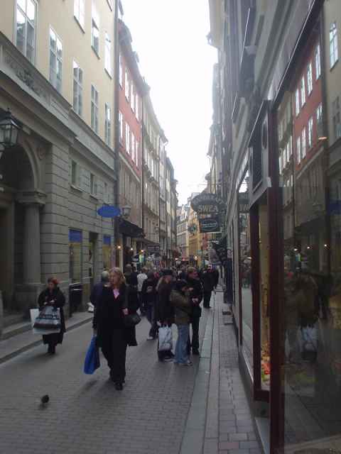
This is what most of the old town of Salzburg looks like.
2006-12-27 12:31

This is the Salzburg Fort. You can walk up to it. You can even follow the signs to the funicular, end up on the now-abandoned midway platform where the funicular doesn't stop, walk up the last bit, realize that you're one euro short of the admission fee and that they don't take any cards and walk down promising yourself that the fortress will be among the first buildings to go once nuclear weapons become ubiquitous, but once you hit ground level again you'll probably just gorge youself silly on pastries. Then you take the funicular up.
The only time the fortress was beseiged was in 1525 when a group of miners and townspeople tried to oust Prince Archbishop Cardinal Matthäus Lang. The fort was surrendered without a fight during the Napoleonic Wars, by which time it had ceased to have any military significance.
2006-12-27 12:24

 toward the sun-lit, covered-in-ice, side of the peak. The designer's name was Lisa Salvador - and I haven't been able to find any pictures of her clothes, but then again she probably isn't designing them for people who buy clothes on the web.")
While I did my photography a small photo crew was finishing up their fashion shots just outside the top cable car station. Here they are, walking away (the model in high heels and walking sticks) toward the sun-lit, covered-in-ice, side of the peak. The designer's name was Lisa Salvador - and I haven't been able to find any pictures of her clothes, but then again she probably isn't designing them for people who buy clothes on the web.
Update 2013-11-22: Re-visiting this entry I decided to take another look at the web, and found that Lisa Salvador has been on the web since 2008 at lisasalvador.de[c].
2006-12-27 10:38

View north along the east side of the mountain..
2006-12-27 10:29


A metal cross at the top. When blizzards hit it turns into a cross of snow and ice with the metal skeleton completely covered.
2006-12-27 10:19

Memorial to alpine rescuer Josef Gassner who fell to his death here February 10, 1946 "while on duty".
2006-12-27 10:18


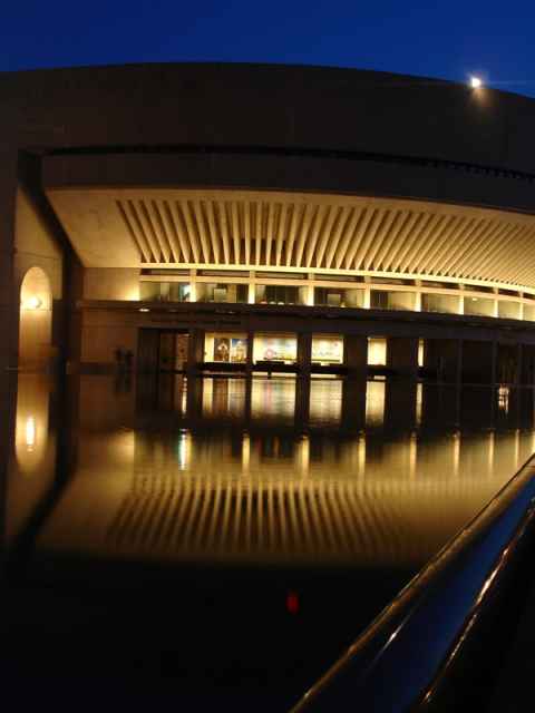
The cafeteria, with its Hundertwasser-like decoration.
2006-12-02 15:13


An example of the undulating floor that Hundertwasser considered to be "a melody to the feet".
2006-12-02 14:55

.")
This water-spiral is found in the lobby. The water is pumped upwards along the spiral to fall from it's peak at the center. Similarly, the stairwell is built so that the spiralling stairs are centered above the water-spiral (although the stairs twist in the opposite direction going up).
2006-12-02 14:29
:")
The entrance to the KunstHausWien. On top of the building flies the Koru Flag[d], an alternative flag for New Zealand designed by Hundertwasser. It includes the spiral, one of Hundertwasser's trademark shapes (if not the trademark shape):
The spiral is where lifeless matter is transformed into life.
2006-12-02 14:28


View of the market from above the subway station entrance.
Ich bin noch'n Wiener - Karlsplatz
2006-11-30 18:00


Geocode is slightly off - I'm supposed to be at Mahlerstrasse, which is about 100 meters south. GPS:s don't work that well in cities with big, sky-and-satellite-blocking buildings, though, so this is only to be expected.
2006-11-23 19:05

Really bad geocode places me several kilometers off.
2006-11-23 18:41


Spot on geocoding places me in Leopoldau, at the northernmost end of the U1 subway line.
2006-11-23 18:10

Taken from the Donauinsel. Geocode agrees - sort of - Google maps places me in the water by the shore when using satellite imagery, but right when using the "Map" view.
2006-11-23 17:41

Taken from the Donaupromenad across the Danube river. Geocode was ok.
2006-11-23 17:14

Railroad car. I don't think you'd even be allowed to let condemned men ride in a car like this anymore.
2006-10-18 15:03

Government poster. "Even without him, show discipline!"
2006-10-18 15:19

Government poster. "The anti-social has no consideration in street traffic." Fun fact: The word "anti-social" is the same word used by the Nazis to denote "enemies of the people"[e].
2006-10-18 15:19

A "transformer chain". The chain is charged by turning the crank at the far left, and then proceeds to pump water to the top tank, which drives a generator, which powers the two spotlights on the little car, which illuminates the solar cell, which drives the car up the slope...
2006-10-18 14:37


This pretty much sums up the first couple of decades with cars. As always, it took quite some time to work out the kinks in the system. For example:
-
How do you mark pedestrian crossings? (First attempt to do so was in 1926, when cars had been in Vienna for at least twenty years. In 1910 Vienna had about 4000 cars.)
-
How many traffic signs should there be? (Drivers thought sixteen were far too many.)
-
...and so on...
2006-10-18 14:32


Modern buildings at the foot of the hill where Bratislava Castle stands.
2006-11-12 15:32


The storm drain of the courtyard, picture taken from below.
2006-11-12 15:08


View of the Danube and the western part of Bratislava from Bratislava Castle.
2006-11-12 15:01


St. Martin's Concathedral[f], seen from Bratislava Castle.
2006-11-12 14:48

View of the old part of Bratislava from Bratislava Castle.
2006-11-12 14:47

In honor of MTV's Beyonce weekend, we present this statuelicious work of art.
2006-11-12 14:40


 across the Danube.")


In Bratislava, just coming out of the central garage.
2006-11-12 12:55

Wind turbines on the way to Bratislava. Apparently, the area between Vienna and Bratislava is one of the windiest places in Europe.
2006-11-12 12:22


.")
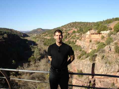
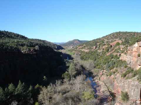
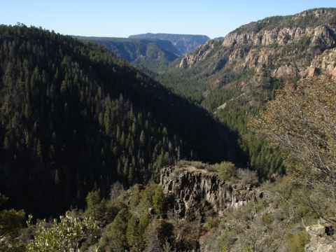
View north from a bit up on the Gemeindealpe (the massive immediately south of the Ötschergräben).
2006-11-11 13:59

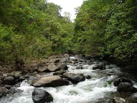
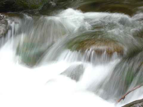
Following a small brook upstreams. Shortly after the picture was taken we turned ninety degrees right and went up the side. Harder than expected with slippery trainers.
2006-11-11 13:33


Memorial found a bit into the Ötschergräben. It commemorates the 450th anniversary of Martin Luther's posting of his 95 theses[g] and with that, the start of the Protestant Reformation.
2006-11-11 13:04
")
Cliffs near the starting point. These in particular are on the other side of a dam that bottles up the Eralaufstausee and keeps it from pouring out northward. (The picture was taken from the west end of the dam - on the map[h] this would be where the Ötscherstrasse crosses the northward pointing stream.)
2006-11-11 12:22

The west end of the Eralaufstausee, and the start of our hike.
2006-11-11 12:20
.")
View south from Annaberg showing the Ötscher (mountain).
2006-11-11 11:54

2006-11-11 11:52

Main building of Kista Gård, the farm that the current suburb took its name from.
2006-10-22 21:16

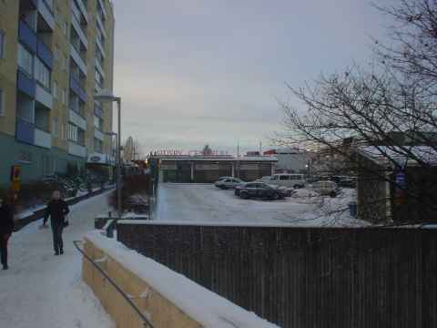
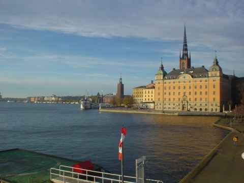
Northern corner of Husby, a suburb of Stockholm, as seen from a nearby hill.
2006-10-22 21:37

Kista Galleria, a little bit farther away.
2006-10-22 20:30
View of Kista Science Tower behind Kista Galleria (a shopping mall).
2006-10-19 19:14

Filmstaden cinema at the Haymarket Square.
2006-10-19 18:02

View northeast from Observatoriekullen in central Stockholm.
2006-10-19 17:46


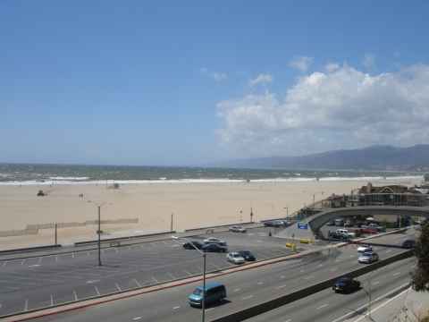
Some kind of movie production taking place on the 3rd Street Promenade.
2006-10-03 14:52

War Memorial. The pillars commemorate war dead from the Army, Marines, Navy, Air Force and Coast Guard.
2006-10-03 14:09


This is where I had dinner. Good to know that I pick top restaurants.
2006-10-02 19:06


The entrance to the hotel. You can also get to the restaurant from here.
2006-10-02 13:36


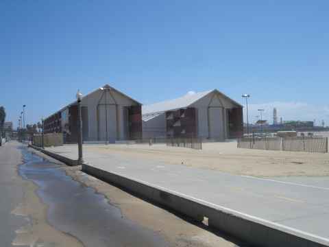
About two hundred miles from Los Angeles is Morro Bay, where this huge granite block marks the entry to the bay.
Pacific Coast Highway, South (Part II)
2006-10-02 13:07

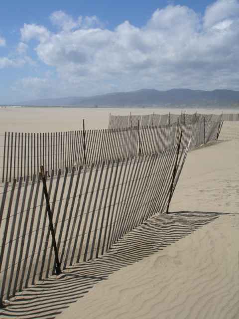
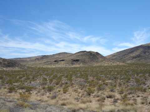
Everything is covered in either trees or dense, arid-hardened brush.
Pacific Coast Highway, South (Part II)
2006-10-02 11:11

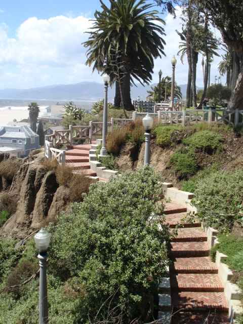
This is the end result of that process - steep hills diving into the water, and sharp ridges where the water didn't erode the rock.
Pacific Coast Highway, South (Part II)
2006-10-02 10:39

Well, you know what to expect. The coastline has been formed by erosion of the hills when rainwater flowing down into the sea carved out a myriad v-shaped canyons.
Pacific Coast Highway, South (Part II)
2006-10-02 10:02


The Lone Cypress, the symbol of Pebble Beach, has been sitting on its rock for at least the past 250 years.
2006-10-01 15:51


Sea birds are everywhere and this one seems to have staked its claim to a big rock.
2006-10-01 15:28

But pretty soon you get to see the sanctuary. The "Restless Sea" as this place is called has rock formations stretching out in the shallow water, making the water foam far from the shore.
2006-10-01 15:27

Unfortunately there is a bit of a mismatch between what the guidebook says and what really is there. After reading this sign, if you were to lift your eyes to the horizon, you'd see this[j].
2006-10-01 15:06


The other major inhabitant of the pier. Sea lions fill the air with their characteristic noises.
2006-10-01 11:47

One of the inhabintants of the pier. These birds are completely unafraid of people. Yu can walk up to them and they won't even bother looking at you.
2006-10-01 11:46


On the way down I went past Santa Cruz and did the 17 mile drive at Pebble Beach, but then I went down toward Point Sur to enjoy the sunset. This is Andrew Molera State Park just south of Point Sur.
2006-10-01 17:19

The weather was only so-so when I started out at SF. Understandable, since San Francisco had an almost central-northern European weather when I was there. No running around in shorts in late September here.
This particular stretch of road is known as Devil's Slide[k] due to the frequent land slides.
2006-10-01 10:25

")
My two teas - the left one is "Monkey Picked Tieguanyin" and the right one is "Silver Needles". You start off by soaking the leaves in a splash of water and smelling them. Then you fill the cup with water and use the lid to push the leaves around, squeeze them against the side of the cup and push them into the water. (The people working there will give you a quick rundown on how to do this.)
2006-09-30 17:35

This is what is served: One cup for each sort of tea that you have ordered, and a kettle of hot water. The tea leaves are already in the cups.
2006-09-30 17:16

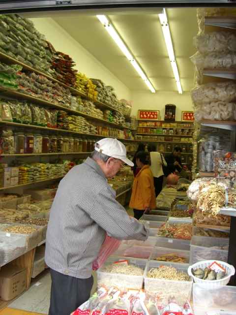
This is the interior. A plethora of tea cups, tea tasting sets and bags of tea fill the shelves.
2006-09-30 17:10

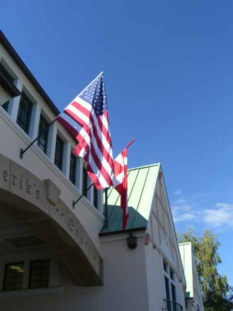
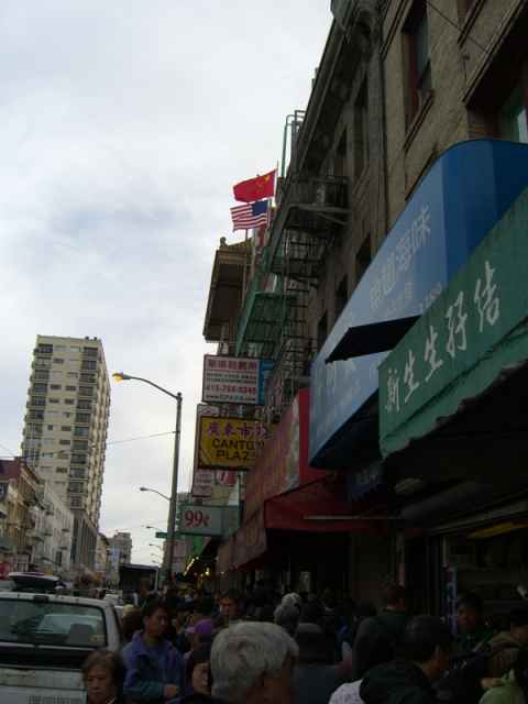
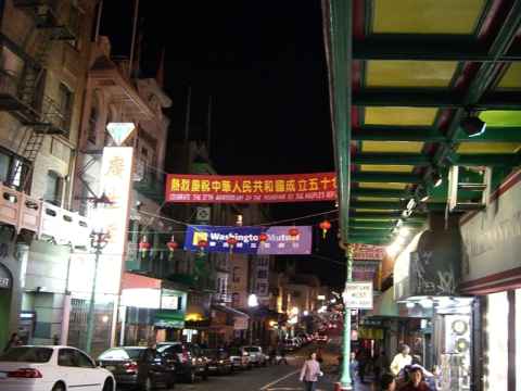
The gate to Chinatown. The area known as Chinatown isn't walled in any way, but there is still a gate.
2006-09-30 20:29
 made history when she was appointed as the first Chinese American woman judge in 1981. Serving as a judge for 22 years, Judge Sing held almost every type of assignment in both criminal and civil courts, and also pioneered Drug Court, where drug addicted persons receive treatment and counseling, before retiring from the bench last year. - Asian American Bar Association")
Judge Lillian Sing (...) made history when she was appointed as the first Chinese American woman judge in 1981. Serving as a judge for 22 years, Judge Sing held almost every type of assignment in both criminal and civil courts, and also pioneered Drug Court, where drug addicted persons receive treatment and counseling, before retiring from the bench last year.
- Asian American Bar Association
(You can read more about her using the Wayback Machine[l].) Apparently she didn't like retirement and campaigned to get back. How did she do? She won.[m]
2006-09-30 17:01


The Transamerica Pyramid[n], one of the easiest recognizable landmarks of San Francisco. While it no longer houses the Transamerica insurance company, the company still has the pyramid in its logo, as you can see on their website[o].
2006-09-30 21:32


View of the tower with the statue of Christopher Columbus in front.
2006-09-30 16:26


The Russian Hill. This picture gives you an impression of how hilly SF really is.
2006-09-30 16:17


A tram. The trams are driven by cables being pulled through the "middle rail" that you can see. The cables are continuously running and the car is driven by gripping the cable or by applying brakes. You can try driving a tram at Gripman's[q].
2006-09-30 12:57

This is the bendiest street in all of the world. It is Lombard Street, on top of the Russian Hill.
2006-09-30 12:54


This pictures shows the hilly nature of San Francisco. If you aren't either ascending or descending a steep hill, you have probably left SF altogether.
2006-09-30 12:43


...and a lot of stores. In particular camera stores and camera accessories seemed to be the most common stores.
2006-09-30 12:06

On the other side of the Golden Gate bridge and a little bit to the east is Fisherman's Wharf where you can find old ships...
2006-09-30 12:03


At Point Spencer you can see what's left of Battery Spencer[r], part of Fort Baker. The circular slab is one of three used to mount the battery's 12 inch guns.
2006-09-30 10:59
, driving over the rollercoaster-shaped Richmond-San Rafael Bridge. From there I went south to Point Spencer.")
I drove from Modesto to Oakland and over the bay to San Rafael (in which the term "420[s]"[t] originated), driving over the rollercoaster-shaped Richmond-San Rafael Bridge[u]. From there I went south to Point Spencer.
2006-09-30 10:58

El Capitan. A favorite among climbers and base jumpers.
2006-09-29 15:57


Bridal Veil Falls. There is more water flowing through here in spring.
2006-09-29 15:44
, Half-Dome (the almost white peak curving up in the background in the middle of the picture) and Bridal Veil Falls (just to the left of the top of the right foreground pine trees - you only see a small vertical white line).")
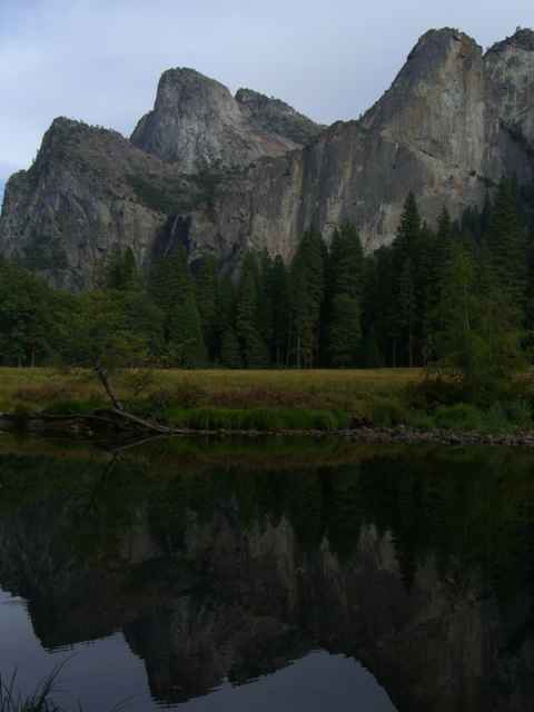
The "tunnel view" of the Yosemite Valley. It is called "tunnel view" since it is right at the mouth of a tunnel that you drive through to enter the valley from the south. From this point you can see El Capitan (the steep bare rock face to the left), Half-Dome (the almost white peak curving up in the background in the middle of the picture) and Bridal Veil Falls (just to the left of the top of the right foreground pine trees - you only see a small vertical white line).
2006-09-29 15:33

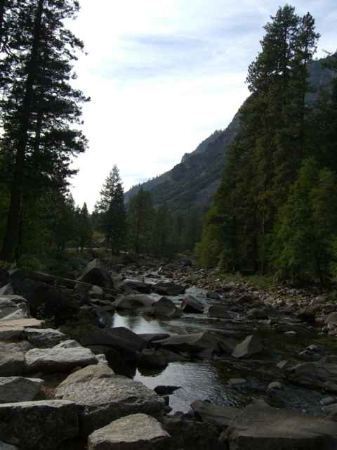
All streams in Yosemite are fed by snowmelt from the mountains. Since I'm visiting in September, when the spring floods are over and there hasn't come any more snow, the streams are near empty.
2006-09-29 14:53


They stand like giants among the other trees in Yosemite.
2006-09-29 14:31


The vegetation shifts from desert brush to trees as you near Yosmeite.
2006-09-29 14:15

And then you're back up in the hills again as you leave Fresno on highway 41.
2006-09-29 13:45

The mountaneous terrain north of LA give way to the flat valley.
2006-09-29 10:07

Bound for Yosemite on the 5 freeway. The picture doesn't show it, but I'm going downhill fast.
2006-09-29 09:51

2006-09-28 17:30


The vents that can be seen on the top of the hood are the intakes for the supercharger. With all the trimmings, the modifications add 450 horsepower to the base engine.
2006-09-28 14:13
 Their specialty is to modify Mustangs - give them a new gearbox, add a supercharger, racing seats and so on. Their motto - as can be seen here on this Mustang parked right smack in the middle of the Spectrum - is \"Power in the hands of a few\".")
Saleen is an auto parts store for people with deep pockets. (It is also a t-shirt and baseball cap shop for people with shallower pockets.) Their specialty is to modify Mustangs - give them a new gearbox, add a supercharger, racing seats and so on. Their motto - as can be seen here on this Mustang parked right smack in the middle of the Spectrum - is "Power in the hands of a few".
2006-09-28 14:12


Arrangement in the nearby mall. Look at the white stone between the two light-green plants... Looks strange, right? Well, it is a loudspeaker. Playing soothing shopping music. Am I the only one who gets associations to the comedy scenes about the old Soviet Union where they would find microphones in flower boquets?
2006-09-27 16:16


Richard Henry Dana, the guy they named the place after.
2006-09-27 15:53


The destination - Wilson Creek Winery.
2006-09-27 10:26

Lake Elsinore, just as the Ortega Highway comes down from the mountains near the coast.
2006-09-27 08:58
, but living in Dana Point the Ortega Highway was much easier.")
This time I took the Ortega Highway to Temecula. When I lived in Irvine it was alwas easier to take the I-405 to the 55 to the 91 to the I-15 (look that up on a map if you have to...), but living in Dana Point the Ortega Highway was much easier.
2006-09-27 08:38

London from above as we approach Heathrow. The tall buildings seen in front of the engine intake is Canary Wharf.
2006-09-26 09:37

More of Austria. The fields give way to the alps.
2006-09-26 07:53

Austria seen from above. The whole region around Vienna is basically a patchwork of fields.
2006-09-26 07:49


Q: How trippin' was your trip?
A: So trippin' that the seats in the departure lounge were on the walls, man!
2006-09-26 06:44

Paddington station, Circle line.
2006-09-14 10:20

Building detail near Embankment.
2006-09-15 20:52

I would not name my business that.
2006-09-15 14:08

Building near Paddington station.
2006-09-16 10:05


Diesel train at Paddington Station.
2006-09-18 14:40

Subway station.
2006-09-18 14:19

The subway corridors. One thing that struck me is how small the corridors in the subway system are. Most places corridors can only barely fit two people abreast.
2006-09-18 14:19

The last remains of British humor.
2006-09-18 14:16

Gallery near Waterloo station.
2006-09-18 14:00


Street near the opera house.
2006-09-18 13:52

Street near the opera house.
2006-09-18 13:17

The opera house.
2006-09-18 13:14

2006-09-18 11:55

Canal boats near Little Venice.
2006-09-18 11:22

A nearby pub.
Museum and Library of Freemasonry
2006-09-18 13:11

Pentagram on the floor immediately in front of the entrance. The top of the start points into the museum.
Museum and Library of Freemasonry
2006-09-18 13:06

Stairwell inside the museum.
Museum and Library of Freemasonry
2006-09-18 13:05

Detail of the entrance.
Museum and Library of Freemasonry
2006-09-18 12:35

Entrance to the grand lodge of London.
Museum and Library of Freemasonry
2006-09-18 12:35


The north end of The Long Water near The Fountains. The Long Water becomes The Serpentine about half a kilometer south.
2006-09-15 13:54


The Albert Memorial between Queen's gate and Alexandra gate near the south-south-west edge of the park.
2006-09-15 12:31


Wall covering display seen at the far end of the museum.
2006-09-14 12:27


2006-09-14 12:10
, and are \"injected\" into the ring where they spin around and illustrate the transfer of energy.")
The "energy ring". The white blocks which can be seen on the underside of the beam connected to the top of the ring can move (the whole inside of the ring is essentially a giant led display), and are "injected" into the ring where they spin around and illustrate the transfer of energy.
2006-09-14 12:03


Just beyond the entrance is this big hall with a model of the Earth. The escalator leads to the Earth galleries, where exhibitions show the structure and composition of the Earth.
2006-09-14 11:02


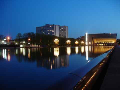
Clouds above the city hall. The dark dot near the center left is probably a lens flare.
2006-08-28 16:40


A rainy day in Stockholm. Picture taken outside Grand Hotel.
2006-08-27 19:58


Igelbäcken as it passes near the subway at Kymlinge.
2006-08-26 19:41

Rowanberries on the way to Kymlinge, near Kista Entre.
2006-08-26 19:23


 found some lamp shades and curtains that could be installed without too much technical skills.")
Finally we (make that Mona) found some lamp shades and curtains that could be installed without too much technical skills.
2006-07-29 18:59


The sun has set on a world utterly devoid of German joy...
2006-07-04 22:36

Germany is out of the world cup thanks to two quick Italian goals in the 118th and 120th minute.
2006-07-04 22:32


Gustav and Annette working their way through the food.
2006-07-04 20:25


Signs in the trenches of World War I showed the way to company headquarters, important points etc. Mostly the sections of trench were named after nearby villages or landmarks. Obviously someone thought that more descriptive names were called for.
2006-07-04 15:23

Thw "War Clock" counts the dead in armed conflicts around the globe. Armed warfare managed to rack up 100 million dead during the 20th century, which translates to about two dead every minute. The clock was reset to 100 million on the eve of the new millennium and has been counting deaths at that rate ever since.
2006-07-04 15:21

Large photograph at the entrance to the World War I and II sections of the museum.
2006-07-04 15:19


A gallery of contemporary Mid East art[aa] was open. This is one of the three statues by Parviz Tanavoli on the way to the gallery. All statues depict the word "heech", meaning "nothingness", as written in farsi.
2006-07-03 14:49

A reproduction of the multicolored decorations that greek columns originally had. This, called polychrome[ab], had completely worn off by the time the ancient Greek temples were inspected by the Victorian English, and so they were left with the impression that classical architecture completely lacked color. Later analysis of the stone revealed the colorful patterns that had once been painted on it, and the replica of the Parthenon in Nashville[ac] reproduces what is thought to be the original colors.
2006-07-03 14:39


A relief depicting Durga[ad]'s battle with Mahishasura[ae]. Durga is essentially the wife of Shiva transformed by the gods into a goddess of destruction in order to have someone who could defeat Mahishasura. With a body forged by the most powerful gods, weapons ranging from Shiva's trident to Vishnu's discus and just a little feeling of being totally über, she made short work of the demon.
2006-07-04 13:04


The £20 grill that provided food for three days straight.
2006-07-03 20:32


This little triangle, called Little Venice, is where the Grand Union and the Regent's Canal join. The area can be seen from above via Google Maps[af].
2006-06-30 11:17

Of of the many specially designed bridges that can be found along the canal.
2006-06-30 11:14


The international rail platforms of Paddington Station. Look at the ceiling near the far end for a demonstration of what a couple hundred years of diesel and coal powered locomotives does with the paint job.
2006-07-01 13:36


Canal boats moored at the end of the Grand Union Canal. The little stump of a canal can be seen here[ag]. The picture was taken approximately where the rectangular blue building is.
2006-07-03 18:00

Statue of Edith Cavell[ah] near Trafalgar Square.
2006-07-04 14:37

Hayward Gallery, another brutalist building.
2006-07-03 16:20

The intersection above the Tottenham Court Road underground station. Go here for a quick walk to the British Museum.
2006-07-03 15:59


Fans charge up for the England - Portugal game.
2006-07-01 15:13

Gift from Switzerland in Leicester square. The canton where gustav lived before moving here has the shield with a horizontal blue bar on white background which is in the second column of the second row on the right hand side.
2006-07-01 14:12


View of the Baker Street station. The light shafts can be seen.
2006-06-29 14:37

Light shaft in the Baker Street underground station. The shafts used to be open to the street, but were plugged shut as the road expanded.
2006-06-29 14:37

Sunset behind the Millennium Tower as seen from the Copa Cagrana restaurant area.
2006-06-21 20:25

, most have a very smooth asphalt surface.")
The island has great bicycle and rollerblade paths. While some paths use cobblestones (as can be seen on this picture and the next), most have a very smooth asphalt surface.
2006-06-21 19:22


View from the - for lack of a better word - battery.
2006-06-21 13:28

The island has these insanely powerful sprinklers placed along it that drenches anything within a semicircular area in front of it.
2006-06-21 13:23


These two toga-clad women were handing out flyers for the new opening of the floating Caesars Palace[aj] nightclub.
2006-06-21 20:34


The "Wiener Neustädter" altar. The base of the altar has Emperor Frederick III's A.E.I.O.U.[al] inscription on it. Too bad he forgot to tell anyone just what the inscription meant - maybe it's one of those "you just had to be there to get it"[am] things.
2006-06-21 15:20

The High Altar. Took seven years to get it right.
2006-06-21 15:14


...and the couch and table... do you have a binder? Great, thanks... and a hole punch... some tape... a couple of boxes...
2006-05-31 12:03
")
We don't take up much space, just this little corner... and this part... and this... and please ignore the haunted african statue... (yes, it may put a hex on you if you don't leave it alone...)
2006-05-31 12:03

View down toward Vienna from the memorial.
2006-05-25 16:52

On top of the Leopoldberg is this memorial to Austrian prisoners of war from the second world war.
2006-05-25 16:55
. The Leopoldberg was the site of the Battle of Vienna, where the Holy League routed the forces of the Ottoman Empire in 1683.")
Looking down at Vienna from Leopoldberg. The river is of course the Danube, with the Old and New Danube rivers on each side of the Donauinsel ("Danube Island")[an]. The Leopoldberg was the site of the Battle of Vienna[ao], where the Holy League[ap] routed the forces of the Ottoman Empire[aq] in 1683.
2006-05-25 16:40

At Heiligenstadt train station you'll be faced with Karl Marx Hof[ar], an aptly named brutalist style[as] building.
2006-05-25 16:01
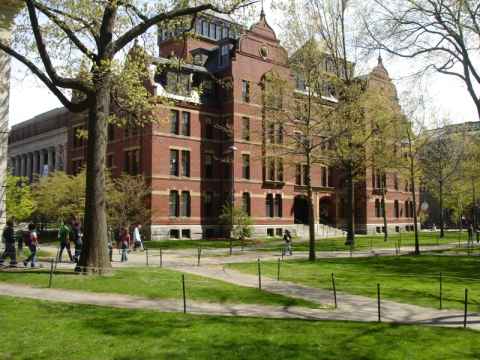

The statue of John Harvard, commemorating his founding of the university in 1638. Actually, that sentence has three lies in it:
-
John Harvard didn't found the university, he just donated so much to it that it was named after him a couple of years after is was founded.
-
The university was founded in 1636.
-
The person depicted isn't John Harvard - nobody knows what he looked like. Somebody else sat as model.
2006-05-01 14:23

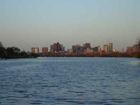
A picture of the Manhattan skyline as the bus leaves for Boston.
2006-04-26 19:16

Of all streets in NY, I think Wall Street is the only one where I've really felt the high-rise buildings on the sides of the street really give the area a claustrophobic feel.
2006-04-26 17:55


The Almighty Buck starts and stops here.
2006-04-26 17:48


Statue outside the US Customs building.
2006-04-26 17:41

A curch near battery park.
2006-04-26 17:35

The statue of liberty. The vertical smudge to the right in the image is caused by lens damage.
2006-04-26 16:08

Battery Park. The slabs list dead US sailors.
2006-04-26 16:08


Battery Park City.
2006-04-26 15:49

Inside the Winter Garden at World Financial Center, the complex right next to WTC.
2006-04-26 15:31

A view of the rebuilding effort.
2006-04-26 15:24

Flowers at Ground Zero.
2006-04-26 15:24

The World Trade Center Cross[at], a cross-shaped remnant of the exterior wall of WTC.
2006-04-26 15:22

Ground Zero - this is where the World Trade Center used to be.
2006-04-26 15:21

View of The Lake in Central Park.
2006-04-26 14:37

The Turtle Pond in Central Park.
2006-04-26 14:27

Statue of Alice in Wonderland in Central Park.
2006-04-26 14:17


This is a public service announcement. When you buy tickets at Empire State Building, you will be offered to go to the 102nd floor observatory for another $14. This is what you will get. A submarine-like room with dirty windows. As the life operator said: "It's stopid. Nuthin' disastrous, juss' stopid." Stay on the 88th floor and save your money.
2006-04-26 13:22

The view south from the observatory.
2006-04-26 13:12

"Proof of life" from the 88th floor observatory of Empire State.
2006-04-26 13:09

Empire State building, as seen from the street.
2006-04-26 12:29

The bus will drop you off in Chinatown.
2006-04-26 11:40


View of the Italian quarter from a safe distance.
2006-04-25 14:44
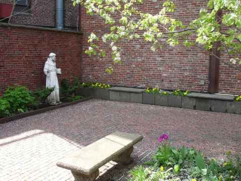

Statue of Francis of Asissi[au].
2006-04-25 14:35


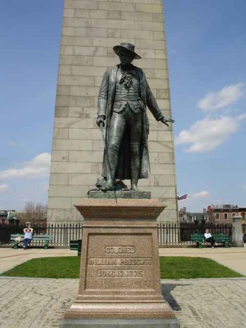
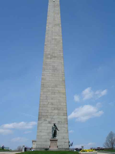
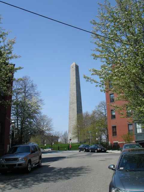
Veteran's Memorial near Bunker Hill.
2006-04-25 14:20

Trees in bloom near a veteran's memorial.
2006-04-25 14:20


A street on Bunker Hill.
2006-04-25 14:13

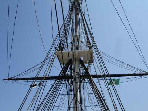
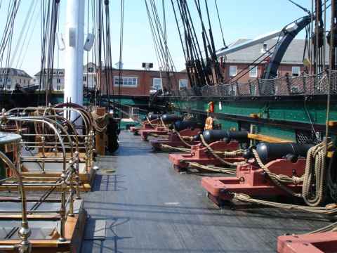
Old railway car near USS Consitution.
2006-04-25 13:25


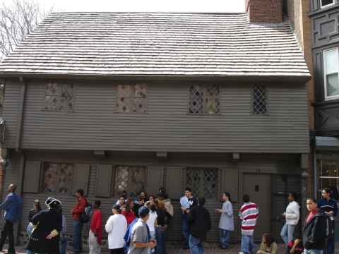
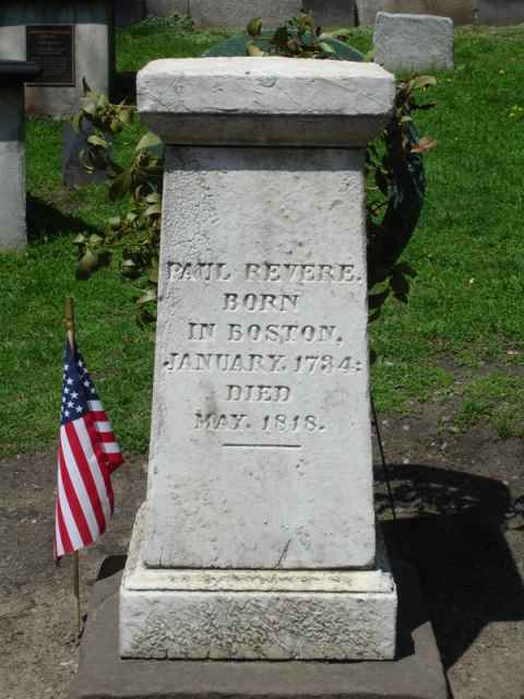
A small park near Paul Revere's house.
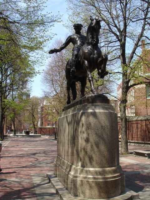
2006-04-25 12:59

Street in the Italian quarter.
2006-04-25 12:47

Entering the Italian part of town.
2006-04-25 12:47


The Red Sox is not as much a baseball team as a state religion.
2006-04-25 12:29

Benjamin Franklin. This is the first statue in the US that showed the person depicted in typical clothes. Other statues, such as the one of Quincy Adams just ten meters away, used the old heroic / roman style of clothing.
2006-04-25 12:21


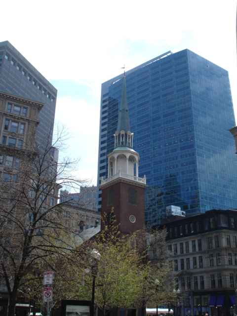
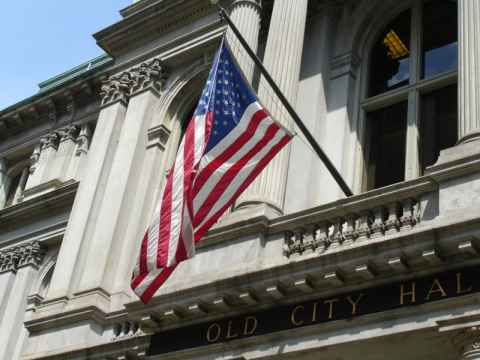
A hopscotch outside the old city hall. The building also served as the first public school.
2006-04-25 12:19

.")
2006-04-25 11:44

The place I'm staying at, 199 Park Drive.
2006-04-25 11:26


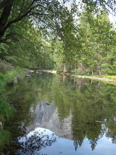
Linville Falls. The water is usually clear, but rainfall had brought with it soil, making the waters muddy. In addition, the stream was also about three times the size it would have been on a dry day.
2006-04-23 15:30


A picture of my hosts in Charlotte, Mimi and Bernard Clarke.
2006-04-23 12:36


The "Hawkbill" trail, leading up to the peak of the same name. The rock outcrop at the top gives the peak the silhouette of a hawk's bill.
2006-04-23 11:57

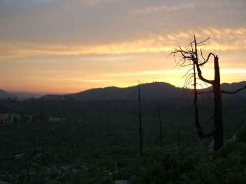
The view from Bernard and Mimi's summer home in the mountains.
2006-04-23 11:26

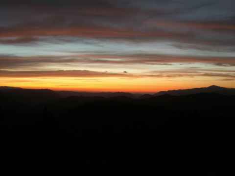
South Carolina sunset, somewhere along the I-77.
2006-04-22 19:58
 at Patriot Point.")

Memorial to Cold War submarine crews at Patriot Point, across the river from Charleston.
2006-04-22 16:24
 drink. Later, the pub owner would announce that unfortunately there would be no fight, but that tickets for the next day's fight could be bought.")
The "Blind Tiger Pub". During the era when liquour could only be sold in amounts dictated by state law, an entrepenurial spirit set up a chain of "Blind Tiger" pubs. The pub would sell tickets to a fight between two such animals. When the spectators showed up they would be treated to a "complimentary" (and therefore not "sold") drink. Later, the pub owner would announce that unfortunately there would be no fight, but that tickets for the next day's fight could be bought.
2006-04-22 15:56


P.C.F. Beauregard
General
Commander Confederate Forces
Charleston, South Carolina
Held this city and harbour
inviolate
against combined attacks
by land and water
1863 - 1864 - 1865
2006-04-22 12:46
, City Hall (munipical law), the Federal Building and U.S. Post Office (federal law), and Saint Michael's Episcopal Church (canon law).")
The "four corners of law" intersection. On the corners are the courthouse (state law), City Hall (munipical law), the Federal Building and U.S. Post Office (federal law), and Saint Michael's Episcopal Church (canon law).
2006-04-22 12:43

The Circular Church[ay], a very old church with an amazing history[az].
2006-04-22 12:24


Memorial at White Point. A coastal battery used to be placed here.
2006-04-22 11:17

Second South Carolina Regiment
Army of the Revolution
Organized June 17, 1775
To the defenders of Fort Moultrie
June the 28th, 1776
2006-04-22 11:16


Row of houses near White Point, the southernmost point of the peninsula where Charlestown is situated.
2006-04-22 11:04

 gardens. The garden here came witha sign that said \"please enjoy the garden from the street\".")
The houses usually have very beautiful (and very publically inaccessible) gardens. The garden here came witha sign that said "please enjoy the garden from the street".
2006-04-22 10:56


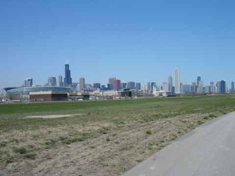
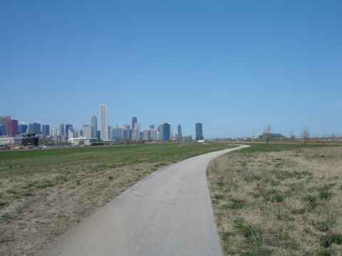
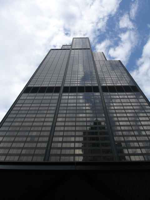
The Chicago water tower, one of the few structures to survive the great fire[ba]. It is now a national landmark.
2006-04-19 17:13

The problem with having a company name with a meaning.
2006-04-19 16:17
")
"The Italian Village[bb]" is Chicago's oldest Italian restaurant, having been open since 1927. (And you know what tax skills[bc] that requires.)
2006-04-19 15:26

Sports in Chicago is not always about winning. For fans of the "Lovable Losers", the Cubs, that is an attitude that must have been born out of neccessity rather than enlightenment.
2006-04-19 14:30

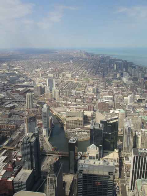
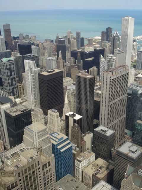
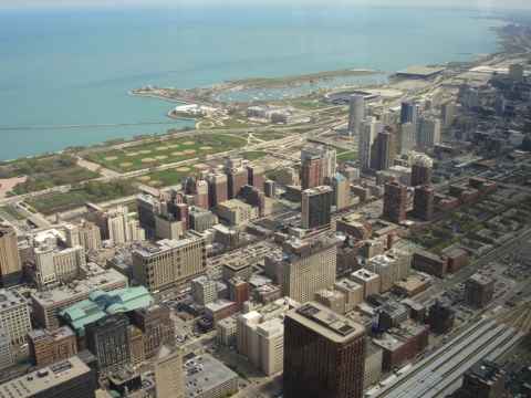
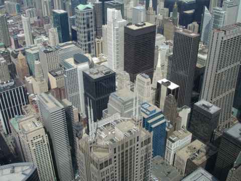


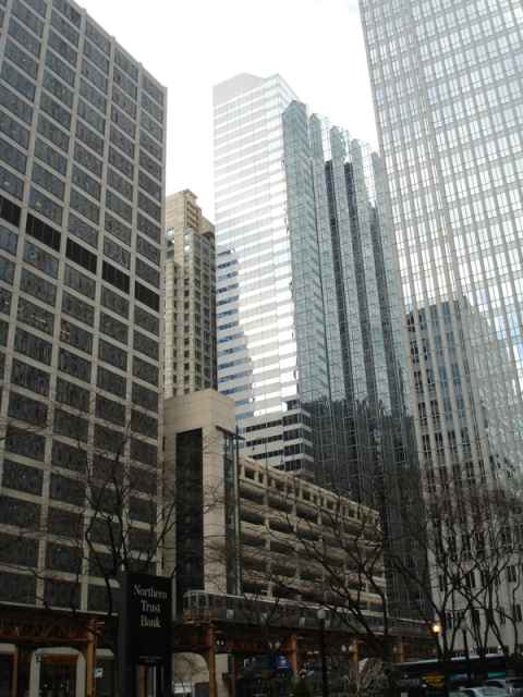
View from Grant Park facing west.
2006-04-18 13:50

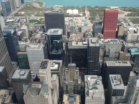
The view from my hotel window. It is East Congress Parkway going across Michigan Avenue[bd] toward the Grant Park.
2006-04-18 13:44

")

Statue of Ka'ahumanu in the Queen Ka'ahumanu Center. All coins thrown in the pool are donated to local charities.
2006-04-17 11:08

Kaihalulu bay looking southwest.
2006-04-16 12:39

Kaihalulu bay, a red sand beach.
2006-04-16 12:22

One of the innumerable one-lane bridges on Highway 360.
2006-04-16 10:58

Close up of the waterfall.
2006-04-16 10:47

A larger stream during light rain.
2006-04-16 10:45

As you stop and hike into each valley you're bound to find the stream that originally carved out the valley. This photo was taken after a light rain, during heavy rain the stream increases in size by a magnitude.
2006-04-16 10:06

Lush valleys fill the seaside view.
2006-04-16 09:18

The road follows the coastline more or less exactly, as can be seen here.
2006-04-16 10:31

The kind of road you get to drive. It doesn't get any straighter than this for fifteen miles in each direction.
2006-04-16 09:02

Q: Why did the chicken cross the road?
A: It didn't. But it would have been better off if it had. It just ran around aimlessly on one side, getting in everybody's way and was nearly run over by at least two cars.
These are everywhere. You see them running around in the streets, and even here, about ten miles from the nearest town, you find them.
2006-04-16 08:52

View of East Maui from Oneuli.
2006-04-15 18:30

Sunset at Oneuli.
2006-04-15 18:27

Trees behind the beach.
2006-04-15 18:22

Note the black grains that give the sand the dark color.
2006-04-15 17:17

North part of Oneuli beach.
2006-04-15 17:07

South part of the beach.
2006-04-15 17:07

I guess I'll step on it, then.
2006-04-15 16:56

A hiking trail follows one of the streams up a couple of hundred meters.
2006-04-15 14:24

The sides of the valley.
2006-04-15 14:36

The "Iao Needle". A piece of denser rock that was embedded in more easily erodable rock, and that remained when the surrounding rock was washed away by rains.
2006-04-15 14:17

The streams going down the bottom of the valley.
2006-04-15 14:01

Winding road between steep cliffs.
2006-04-15 13:45

Entering Iao valley.
2006-04-15 13:45

Frequent bridges allows one to drive over lava flows.
2006-04-15 12:09

The road snakes through the landscape.
2006-04-15 12:29

Highway 31 goes straight through the southern part of Maui, with a huge grass plain to the seaward side of the road.
2006-04-15 12:29

The wine tasting room and souvenir shop.
2006-04-15 11:02

The "King House", now used for wine tasting. The building got the name from the fact that it was built in all haste after the ranch owners had invited the king of Hawaii, and then realized that the king would have nowhere to stay when he arrived.
2006-04-15 11:01

The Winery garden. This used to be where the main building of Ulupalakua Ranch stood.
2006-04-15 10:27


.")


")

The bus used to transport the bikes and trail behind the column of bikers, making sure that no car rams our asses. Who Katrina Farrah is is a mystery.
2006-04-14 10:38

The church. The downhill guide told me that the architecture was full of sacred geometry to channel spiritual power from the surroundings, and that the arches were just like the ones at the bottom of the WTC, making those twin towers, in effect, churches. Anyway. Now you know it, too.
2006-04-14 10:35

Other notable priests include Father Louie. Father Louie Funk. I can't think of a cooler name. I'm sure the name alone was enough for him to "get on up" to sainthood.
2006-04-14 10:38
 Holy Ghost Church. This is a statue commemorating Father Damien's battle to help victims of the plague that scoured the island.")
The trip ended at (I think) Holy Ghost Church. This is a statue commemorating Father Damien's battle to help victims of the plague that scoured the island.
2006-04-14 10:31
")
Obviously the local black market currency. (I really have no idea what this is about. Maybe if you find an avocado you can cash it in here.)
2006-04-14 09:35
, and Sherri Reeve.")
The trip down includes a stop at Makawao. Here you can check out some art galleries, such as Julie Galeeva[be], whose art is far better than her opening hours (closed when I was there), and Sherri Reeve[bf].
2006-04-14 09:20

View down toward the eastern side of the island.
2006-04-14 08:03

Pause for proof-of-being-here pictures.
2006-04-14 08:02
 on the way down. It also has the purpose of making the column look like a bike-mounted half platoon of Papa Smurfs.")
Standard gear for downhill cruising - rain coat and pants, helmet and skiing gloves. The gloves are needed to keep the hands warm at altitude, and the rain gear are used when passing through the clouds (100% humidity) on the way down. It also has the purpose of making the column look like a bike-mounted half platoon of Papa Smurfs.
2006-04-14 07:40

The valley seen is often mistaken for an extinct volcano, but this is not the case. The valley that crosses the southern part of Maui started as two valleys, one in the north and one in the south. As the porous volcanic rock eroded, the valleys extended toward the summit and finally merged, producing a valley that crosses the Haleakala mountain.
2006-04-14 06:09

The valley below is lit up.
2006-04-14 06:08

The point quickly grows into the full sun.
2006-04-14 06:03

Then, suddenly, a point of light appears at the horizon.
2006-04-14 06:01

You can see the clouds coming in from the sea, striking the hills like a giant wave frozen in time.
2006-04-14 06:00

After forcing myself out of bed at 0300 we were taken to the top of Haleakala. At 0530, this is what the horizon looks like.
2006-04-14 05:31

The company Expedia hires is "Maui Mountain Cruisers" and what better seal of quality than a signed photo of the cheerleaders of the Baltimore Ravens?
2006-04-14 04:00

View of Mauna Kea as the plane departs for Maui.
2006-04-13 18:29

The river just above the falls.
2006-04-13 15:03

Rainbow falls.
2006-04-13 14:48

Lava rock formations.
2006-04-13 12:00

The current lava flow. The lava travels through channels in the rocks that open up underwater. The steam plumes indicate where the hot lava meets the seawater. This is where new land is being created.
2006-04-13 11:58

A lava flow going down to the sea.
2006-04-13 11:24

View of the Kilauea caldera from the northern rim.
2006-04-13 10:23

Steam vents. When you stand here with the wind blowing at you, you'llsuddenly feel warm, moist air coming at you. This is steam from the ground.
2006-04-13 09:58

Keanakako'i, a place where the people of old used to mine for stone for tools.
E ki'i a naonao i ke ko'i
I ka lua ko'i i Hawaii;
E naoa ka lawena heihei,
I'a mai a ki huna ahi
I ka hana oia mea.Go and dig out the adz
In the adz pit in Hawaii
Hold, that it be taken out enchanted
Made light; that it may shoot sparks
In doing its work.
In 1877 the pit was covered in lava and stone mining ceased. In July 1974 the pit was covered in another 20 foot of lava caused by eruptions in the crater and merging lava flows.
2006-04-13 09:45

The lava flow of 1974 again, showing the Lua Manu crater.
2006-04-13 09:37

The lava flow of 1974.
2006-04-13 09:37

Inside the lava tube, this time with a long exposure to show more detail.
2006-04-13 09:23

Inside the lava tube.
2006-04-13 09:21

The entrance to the Thurston Lava Tube on the east edge of the Kilauea Iki crater.
2006-04-13 09:20
.")
The Kilauea Iki crater, immediately to the east of the Kilauea caldera (which can be seen in the background).
2006-04-13 09:09

The Big Island around the Kilauea caldera is covered with tropical vegetation.
2006-04-13 09:03
 a great place for snorkeling, and Kahoolawe is (apparently) a great place to blow stuff up, bomb it, or simply hammer it with shells. Thus, Molokini is a popular target for snorkeling people, and Kahoolawe has spent the last fifty-odd years being a popular target for the US military when testing new guns, bombs or just for target practice. I would venture to guess that every spieces known to be inhabiting the islands has at some point been shredded by the boys in gray here. Recently the island has been returned to the State of Hawaii, and the unexploded ordnance is being removed.")
The county of Maui consists of the Island of Maui and the three islands Kahoolawe, Molokai and Lanai. On this picture the very small island Molokini can be seen and on the left part of Kahoolawe. While Molokini is (apparently) a great place for snorkeling, and Kahoolawe is (apparently) a great place to blow stuff up, bomb it, or simply hammer it with shells. Thus, Molokini is a popular target for snorkeling people, and Kahoolawe has spent the last fifty-odd years being a popular target for the US military when testing new guns, bombs or just for target practice. I would venture to guess that every spieces known to be inhabiting the islands has at some point been shredded by the boys in gray here. Recently the island has been returned to the State of Hawaii, and the unexploded ordnance is being removed.
2006-04-13 18:41


Jack's surfboards. Great store for surfers and for posers like me who just want the clothes.
2006-04-11 19:30


View of the sea and oil platforms.
2006-04-11 19:10


An outcrop of the mountain's granite core.
2006-04-10 13:44


A little stream running right next to the top station.
2006-04-10 13:22
.")
The national park on the top. Note the snow-covered ground and pine trees. The temperature was about 3 degrees Celcius (40 degrees F).
2006-04-10 13:13

View from the top. Palm Springs can be seen spread out on the desert valley floor.
2006-04-10 13:12


The gondola. The only one of its kind in the western hemisphere.
2006-04-10 13:01

Picture taken on the way south.
2006-04-09 15:21
, but the promised Wi-Fi connection leaves a lot to be desired.")
The hotel I stayed at in Flagstaff - Super 8 West. Nice rooms, well worth the price ($55 / night), but the promised Wi-Fi connection leaves a lot to be desired.
2006-04-09 07:49

Flagstaff, our quiet little mountain town.
2006-04-09 07:49

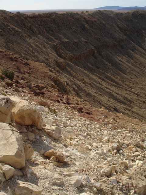
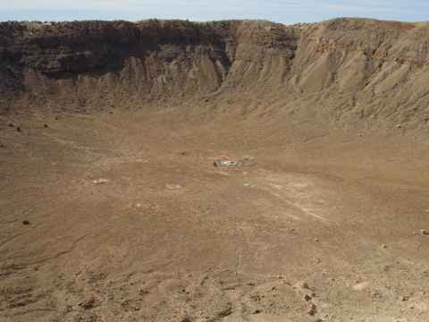
The hole seen from the opposite rim. Note the houses built into the wall - it was a popular way among the people living here of building houses that were well-protected and warm.
2006-04-09 15:56

The well. It is a collapsed sinkhole formed when underground waterflows eroded the overlying strata, forming a cavity. When the cavity grew big enough to not be able to support the top, it fell down, leaving a water-filled hole in the middle of the desert.
2006-04-09 15:52


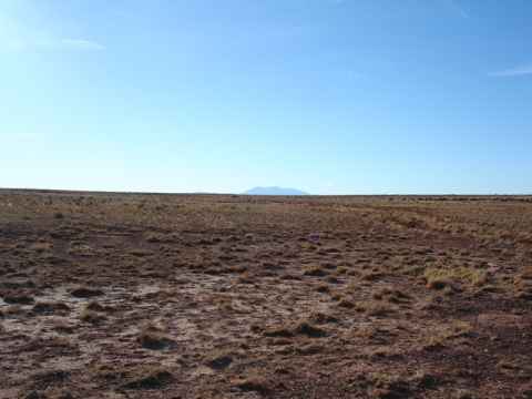
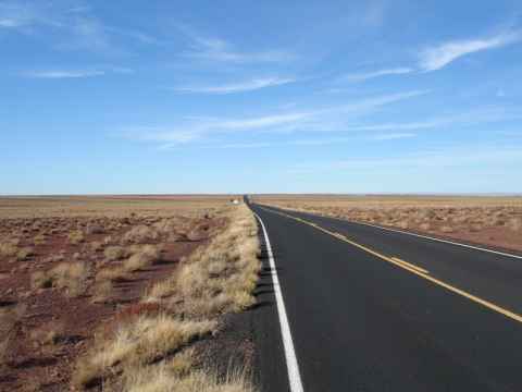
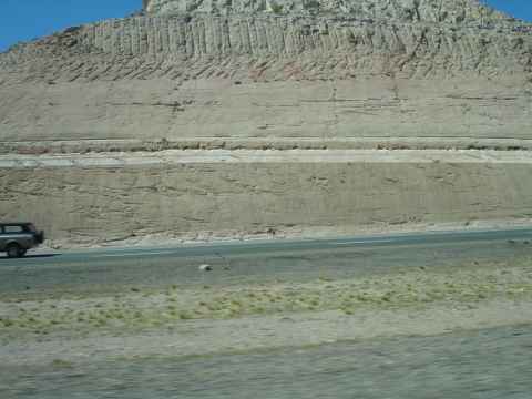
In the north end of the national park is the Painted Desert. The desert was formed via erosion of the many layers that were laid down when seas were covering this place.
2006-04-09 12:45


This area wasn't all bad, all the time. Once, pueblo indians lived here. Their carvings can be seen on stones.
2006-04-09 12:23


The Blue Mesa Badlands. The place is exactly as inhospitable as you would expect from the photo.
2006-04-09 11:53


Closeup of a piece. The tree rings can be seen clearly.
2006-04-09 11:08

The pieces of wood lie strewn across the landscape.
2006-04-09 11:04

An entire petrified tree, complete with roots.
2006-04-09 11:03

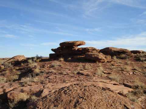
This is petrified wood. When trees grew here in a swamp and were fossilized, the surrounding minerals entered the wood, turning it to stone with a wood pattern.
2006-04-09 10:59


At the end of the performance, anyone who wants to can come up on stage and shake it.
2006-03-26 11:56


A dry flowbed at the southern end of the canyon.
2006-02-04 15:22

View south from the northern end of Red Rock Canyon.
2006-02-04 15:05

As the wind enters the canyon from the north it gets compressed and accelerates. The resulting flow is powerful enough to wear down the rock, creating this smooth, buckled surface.
2006-02-04 14:53


Falcon View Estates - an expensive community in the Santiago Canyon.
2006-02-04 16:02
 before picking the fruit.")
The red fruit of this cactus can be eaten. You should, however, burn off the spines (and there are a lot of them) before picking the fruit.
2006-02-04 14:11


The X-Scream is a sled on a rail that is tipped down over the edge of the tower. To the great disappointment of all Muslim extremists out there, the screaming Americans do not plunge to their death - the sled stops with the first pair of riders sitting just in front of the outermost end of the rail.
I think that someone should do a BASE-jump from the front seat, pretending to be thrown off just to freak everyone out.
2006-01-22 13:29

The Insanity is best described with a picture - like the one to the left. Some sort of manned drink mixer that has been magnified and hauled up to the top of the tower, it probably has more maintenance points dealing with making sure the nuts and bolts are properly fastened than a commercial jetliner.
2006-01-22 13:25

The Big Shot is some kind of pneumatic-turbolift-ish device with a central shaft and a sled with sixteen chairs mounted around it. You sit on the chairs, strapped in with harness and all, and then you're launched along the shaft up, about a hundred feet.
At the top of the trajectory you experience a rather powerful stop and then some serious negative Gs as you're not only propelled upwards, but also pulled down by the machine.
I went with Dave, at about 2200 hours when the sky was pitch black and you could see the neon lights of Vegas stretch to the horizon, with some aircraft taking off and landing - below me.
2006-01-22 13:26


Access to the tower is forbidden, but it still houses some birds of unknown political affiliation.


Close up of the gun tower. Each AAA tower complex consisted of two towers, the gun tower where the AAA guns were fitted, and the fire control tower.


Links
http://en.wikipedia.org/wiki/Salzburg_Cathedral | |
http://en.wikipedia.org/wiki/Salzburg_Cathedral | |
http://lisasalvador.de/ | |
http://en.wikipedia.org/wiki/Koru_Flag | |
http://www.doew.at/information/mitarbeiter/beitraege/rachyg.html | |
http://en.wikipedia.org/wiki/St._Martin%27s_Concathedral | |
http://en.wikipedia.org/wiki/Protestant_Reformation | |
http://maps.google.com/maps?f=q&hl=en&q=mariazell,+austria&sll=37.0625,-95.677068&sspn=53.345014,82.441406&ie=UTF8&z=15&ll=47.834362,15.28018&spn=0.022326,0.054245&om=1 | |
http://maps.google.com/maps?f=q&hl=en&q=mariazell,+austria&sll=37.0625,-95.677068&sspn=53.345014,82.441406&ie=UTF8&z=14&ll=47.871453,15.375967&spn=0.044621,0.10849&t=h&om=1 | |
https://monochrome.sutic.nu/2006/01/01/17_mile_drive2.jpg | |
http://en.wikipedia.org/wiki/Devil%27s_Slide | |
http://web.archive.org/web/20050306003550/http://www.lilliansing.com/about.htm | |
http://www.lilliansing.com/ | |
http://en.wikipedia.org/wiki/Transamerica_Pyramid | |
http://www.transamerica.com/ | |
http://en.wikipedia.org/wiki/Coit_Tower | |
http://www.sfcablecar.com/gripmans.html | |
http://www.militarymuseum.org/BtySpencer.html | |
http://en.wikipedia.org/wiki/420_%28cannabis_culture%29 | |
http://www.sinfest.net/archive_page.php?comicID=2213 | |
http://en.wikipedia.org/wiki/Richmond-San_Rafael_Bridge | |
http://www.tideslaguna.com/ | |
http://maps.google.com/maps?f=q&hl=en&q=london,+uk&ie=UTF8&z=19&ll=51.523414,-0.131503&spn=0.001033,0.00294&t=h&om=1 | |
http://en.wikipedia.org/wiki/Black_Arrow | |
http://en.wikipedia.org/wiki/J-2_(rocket_engine) | |
http://en.wikipedia.org/wiki/Rosetta_stone | |
http://www.thebritishmuseum.ac.uk/middleeastnow/word-into-art/index.html | |
http://en.wikipedia.org/wiki/Polychrome | |
http://en.wikipedia.org/wiki/Parthenon_%28Nashville%29 | |
http://en.wikipedia.org/wiki/Durga | |
http://en.wikipedia.org/wiki/Mahishasura | |
http://maps.google.com/maps?f=q&hl=en&ie=UTF8&ll=51.521328,-0.182304&spn=0.004693,0.013186&t=k&om=1 | |
http://maps.google.com/maps?f=q&hl=en&ie=UTF8&ll=51.518317,-0.174429&spn=0.009387,0.026371&t=k&om=1 | |
http://www.edithcavell.org.uk/ | |
http://i-heart-london.blogspot.com/ | |
http://caesars.cc/ | |
http://www.stephansdom.at/ | |
http://en.wikipedia.org/wiki/A.E.I.O.U. | |
http://sinfest.net/d/20000423.html | |
http://en.wikipedia.org/wiki/Donauinsel | |
http://en.wikipedia.org/wiki/Battle_of_Vienna | |
http://en.wikipedia.org/wiki/Holy_League_%28Great_Turkish_war%29 | |
http://en.wikipedia.org/wiki/Ottoman_Empire | |
http://en.wikipedia.org/wiki/Karl-Marx-Hof | |
http://en.wikipedia.org/wiki/Brutalist | |
http://en.wikipedia.org/wiki/World_Trade_Center_cross | |
http://en.wikipedia.org/wiki/Francis_of_Assisi | |
http://www.mbta.com/insidethet/taag_history.asp | |
http://en.wikipedia.org/wiki/Massachusetts_State_House | |
http://en.wikipedia.org/wiki/USS_Yorktown_%28CV-10%29 | |
http://www.circularchurch.org/ | |
http://www.circularchurch.org/history.htm | |
http://en.wikipedia.org/wiki/Great_Chicago_Fire | |
http://www.italianvillage-chicago.com/ | |
http://en.wikipedia.org/wiki/Al_Capone#Fall_of_Capone | |
http://maps.google.com/maps?f=q&hl=en&q=chicago,+il&ll=41.875233,-87.624657&spn=0.007829,0.021629&om=1 | |
http://www.juliegaleeva.com | |
http://www.sreeve.com/ |